A new-generation field CAD platform from Türkiye

From field to office.
One drawing, every device.

Built for surveying, cadastre and engineering teams, MobilCAD brings professional drawing, coordinate intelligence and secure file workflows together from phone to desktop in one workspace.

NCZLayered projects
DXFPortable CAD
AICoordinate reading
balcik_parselasyon.ncz
276276/1
137137/4
5276/3/T1
NCZ_5531B196
137/4351.63 m²
Reading
coordinates
12 / 12 points
Project up to date
Real coordinatesLayered drawingSecure sharingCloud synchronisationMobile-first
A FIRST IN TÜRKİYE

Not just digitalisation in surveying—
the age of automation.

MobilCAD is automating the journey from raw field data to deliverable technical documents. For the first time in Türkiye, these four critical workflows meet in one mobile CAD experience.

POINT MAP TECHNICAL DOCUMENT
01Beta · Available

Automatic Point Reading

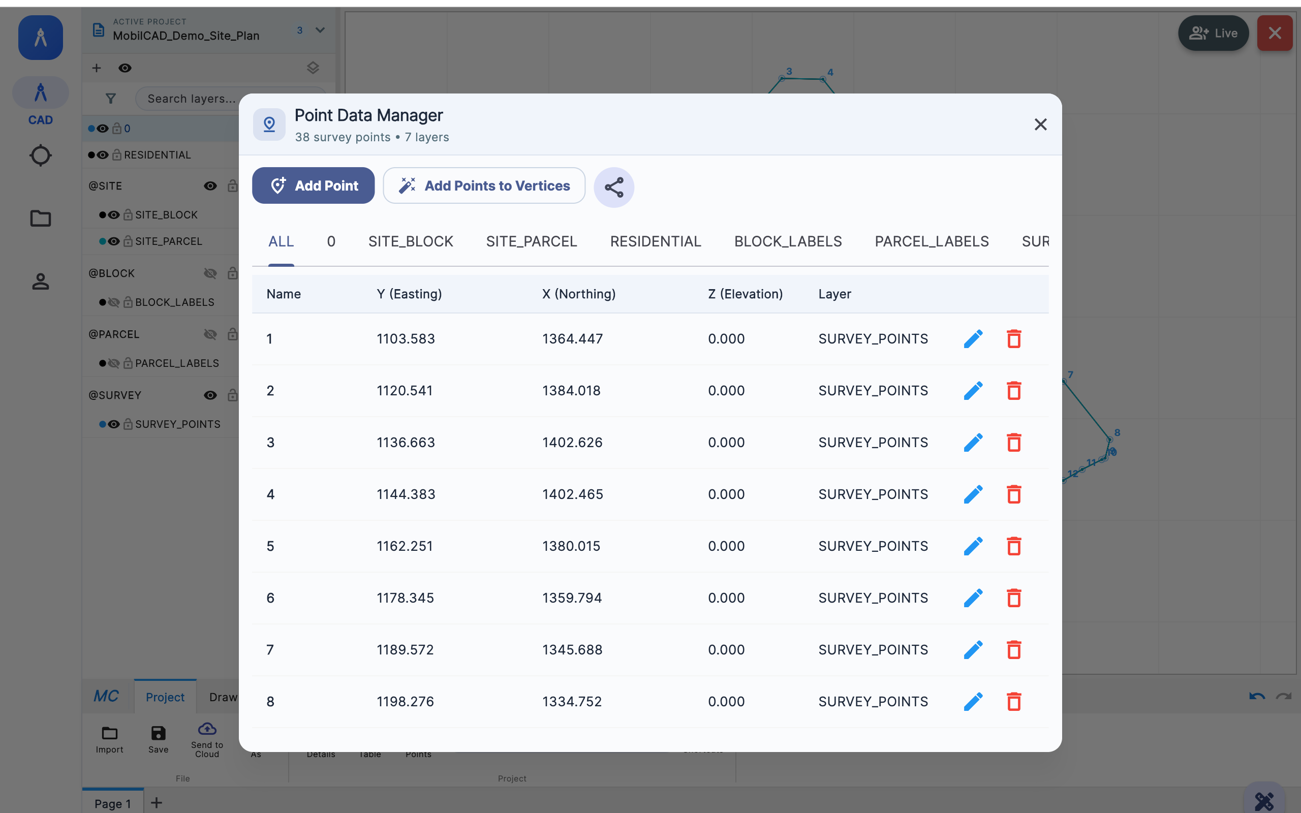
Detects a coordinate table in a camera image, screenshot or PDF with AI assistance and turns point names plus Y and X values into a reviewable table.

02In development

Automatic Map Digitisation

Aims to recognise lines, parcels, labels and coordinate relationships in scanned maps and plans and convert them into editable CAD data.

03Coming soon

Automatic Building Staking Document

Will automate the production of standard staking documents using building corner points and project information.

04Coming soon

Automatic Survey Sketch

Will turn field measurements, frontages and coordinates into an organised survey sketch in a single workflow.

Transparent roadmapThe beta feature is available today; automations marked “In development” and “Coming soon” are part of our active product plan.

A NEW STEP IN MOBILE SURVEYING

Mobile CAD that does more
than view—it gets the job done.

MobilCAD combines critical tasks that normally live in separate desktop tools into one field workflow. Born in Türkiye, this approach aims to make professional CAD genuinely mobile.

01AI-assisted

From a coordinate table to a drawing

Read coordinates from a camera image, screenshot or PDF with AI assistance, review the results and place them at their real-world coordinates.

02Field CAD

Large CAD projects in your pocket

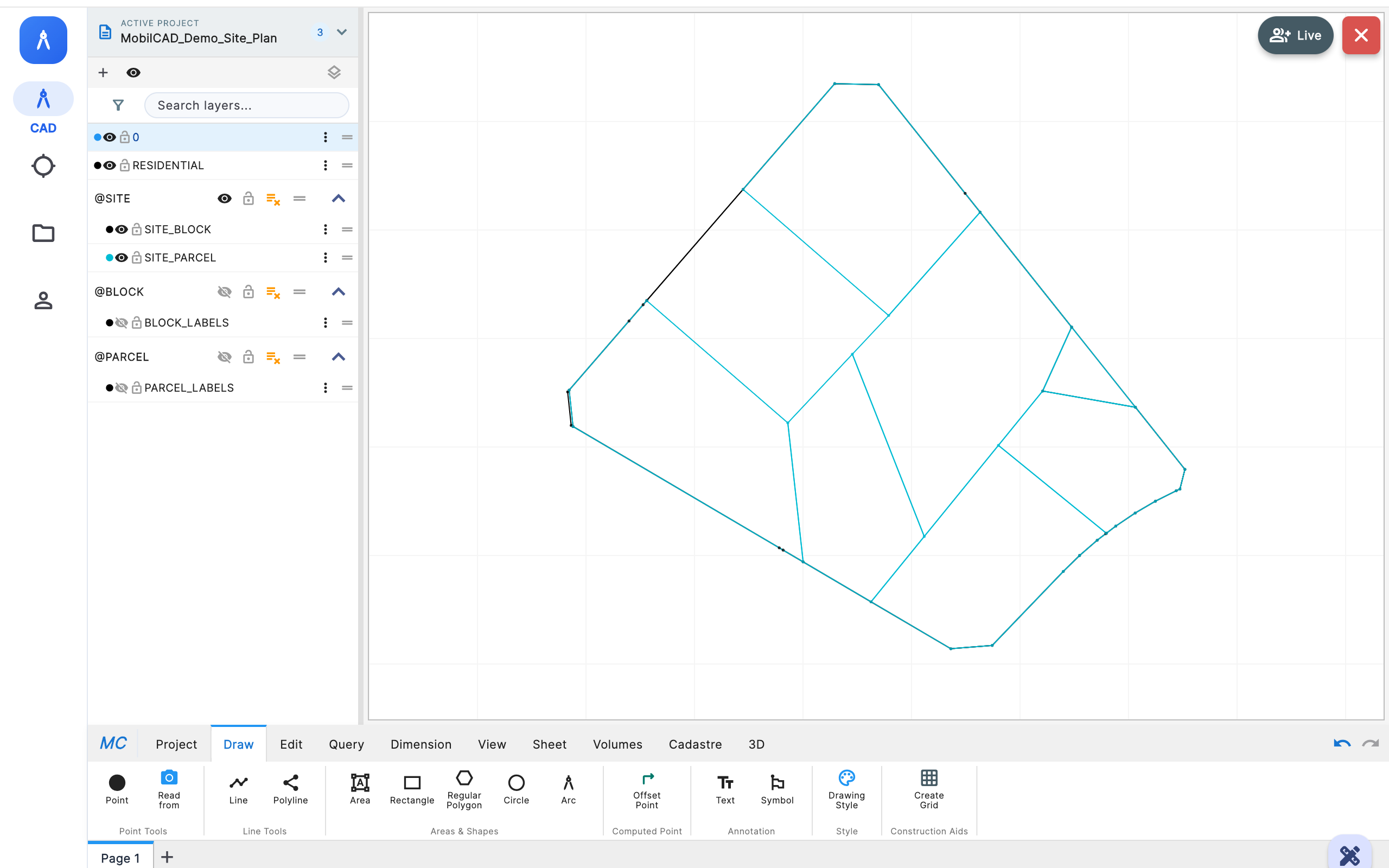
Open NCZ, DXF and MobilCAD project files with their layers. Search block and parcel data, measure, edit and make decisions in the field.

03Cadastre Pool

Secure file sharing

Share directly with a MobilCAD ID, send quickly to colleagues or connect with verified cadastral personnel through an institutional pool.

04Multi-device

The same project on every device

Take your phone into the field, review on a tablet and finish on a computer. Your project, layers and files move with you.

ONE PROJECT, THREE CONTEXTS

Where does the office end,
and the field begin?

With MobilCAD, that boundary disappears. Prepare a file on your computer, open it on your phone in the field and review it with a colleague on a tablet. Keep the latest version and changes tied to your account.

Continuous workflowYour project is account-centred, not device-centred.
01 · OFFICE

Prepare on desktop

Organise layers, review large projects and prepare them for sharing.

02 · FIELD

Work on your phone

Navigate to the location, read coordinates, measure and decide on the drawing.

03 · REVIEW

Share on a tablet

Review detail on a larger screen and keep your team moving in the same file.

MOBILCAD ON EVERY SCREEN

Wherever you work.

Mobile releases bring MobilCAD into the field; the desktop release brings the same experience to large projects and detailed production.

iOS / iPadOS

iPhone & iPad

Test release in preparation
Phone & tablet

Android

Test release in preparation
Desktop

Windows

Coming soon
Store links will become available here at launch.iOS · Android · Windows
ABOUT US

Surveying starts in the field.
Software should work there too.

MobilCAD was born from the real field requirements of surveying, cadastre and engineering work in Türkiye. It does more than shrink desktop CAD onto a smaller screen—it redesigns the workflow across phone, tablet and computer.

01 · MISSION

Make technical production faster, more accessible and more secure.

We bring fragmented tasks—from coordinate reading and drawing to file sharing and field review—into one workspace.

02 · VISION

Build a global field technology company from Türkiye.

We are creating a platform that understands local regulation and professional practice while serving technical teams anywhere in the world.

Field-focusedWe design around real field use, not assumptions made at a desk.
One workspaceDrawing, coordinates, projects and sharing move through the same flow.
Transparent progressWe clearly distinguish available, beta and upcoming capabilities.
MOBILE CAD IS FINALLY MOBILE

Put the field at the
centre of the drawing.

As MobilCAD evolves, new platforms, field tools and institutional partnerships will be announced here.

Follow the platforms